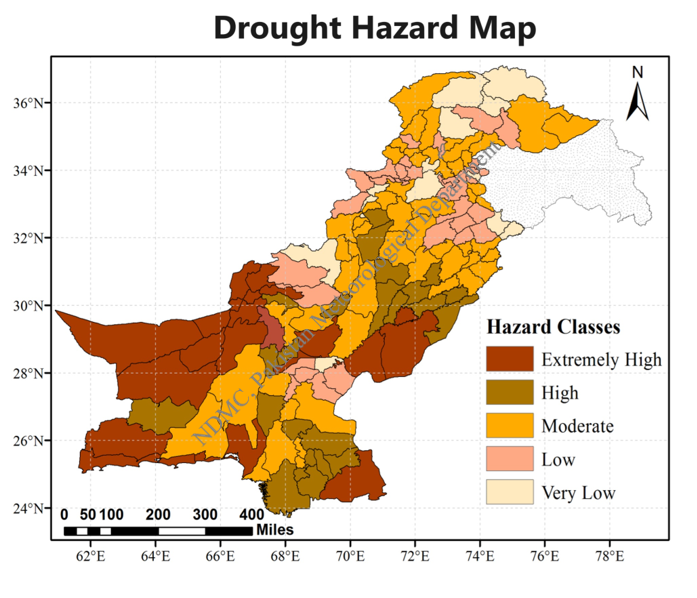
A drought hazard map is a map that shows areas vulnerable to drought by indicating the severity, frequency, or risk of drought conditions in different regions. It helps identify places likely to face water shortages and supports drought planning and management.